


Geo Link
GPS solution for seeders
Geo Link GPS solution for seeders
Flexible GPS connection for maximum precision with your seeder
Geo Link GPS solution for seeders
Flexible GPS connection for maximum precision with your seeder
Geo Link is the new GPS solution from WINTERSTEIGER. It fine tunes the planting accuracy of your WINTERSTEIGER seeder and provides more flexibility for the GPS connection to the tractor. Geo Link provides your WINTERSTEIGER seeder with the GPS position in real time. The use of tractors with special steering systems and an external trigger function is no longer required.
Your benefits summed up:
- Maximum accuracy and geo-referenced planting through evaluation of the GPS position directly on the seeder
Geo Link continuously synchronizes all electric planting and metering drives with the current GPS position of the machine, thus ensuring the targeted absolute positions of the plots and even the individual grains in the trial. This enables a new dimension of planting accuracy for your field trials. By specifying the GPS reference coordinates, geo-referenced planting with Geo Link is easy and user-friendly. - Independence from the tractor's steering system
With Geo Link, no special steering systems with external trigger function (remote output) are required. The GPS connection is established either by connecting to the standard NMEA interface of the tractor via an RS232 plug or optionally via GPS antennas fitted to the seeder. This allows the independent use of different tractors without the cost-intensive installation of specific steering systems. Investment costs are reduced and availability is increased.
- Best trial overview
The field plan is automatically transferred to the Geo Link terminal from the Easy Plant seeder control unit or eMotion to help the tractor driver find their way around during planting. The current position in the field plan is shown on the terminal and the next track according to the planting strategy is displayed on the headland.
- Compatible with all seeders of the new Plot / Row Motion family and the Dynamic Disc Plus
The 9" Geo Link operating terminal can be used with several WINTERSTEIGER machines. Different tractors and machine profiles can be created in Geo Link. The basic settings are stored for each machine and can be quickly changed without having to carry out the offset settings again.
Versions:
WINTERSTEIGER Geo Link is available in two versions: Geo Link Core and Geo Link Pro.
Geo Link Core:
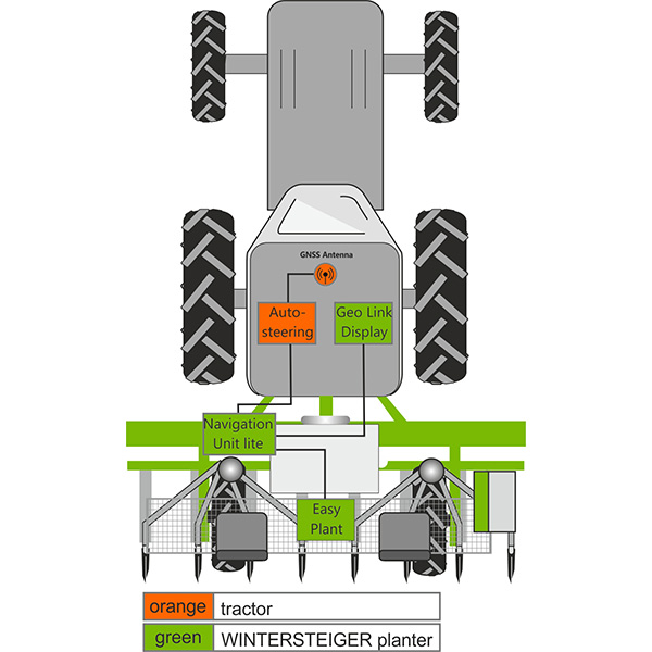
Comprises the 9" operating terminal and the WINTERSTEIGER navigation unit. The GPS connection to the tractor is established via the NMEA 0183 protocol and the RS232 interface of the tractor's own steering system. RTK correction and tilt compensation are performed by the tractor.
Geo Link Pro:
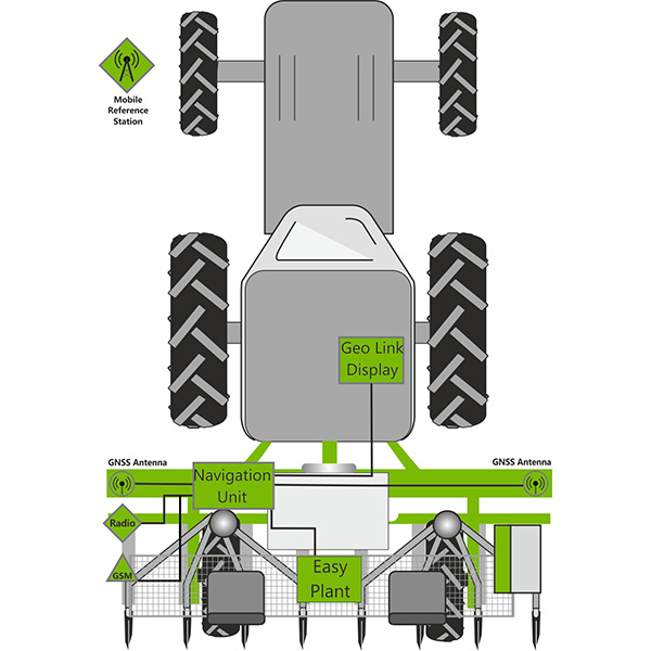
Comprises the 9" operating terminal, the WINTERSTEIGER navigation unit, and two GPS antennas fitted to the seeder. Problems with the offset settings when using different tractors are now a thing of the past, as all offset and equipment settings are made in Geo Link. An integrated cellular modem establishes the connection to an RTK correction data provider (NTRIP server). A mobile RTK station is available for this system as an optional extra, which transmits the correction data to the seeder via a local radio link.
Technical data:
|
|
Geo Link Core |
Geo Link Pro |
|
GPS connection
|
RS232 interface, |
Not required |
|
|
|
|
|
GPS antenna(s) |
On the tractor |
Two antennas on the seeder for exact positioning |
|
Supported satellites |
Depending on tractor |
GPS, GLONASS, Galileo, Beidou |
|
|
|
|
|
RTK correction |
From tractor |
GSM modem for establishing a connection with the NTRIP client or a radio connection with a mobile RTK reference station (optional) |
|
Mobile RTK reference station |
- |
Optional, radio connection to the navigation unit on the seeder. With tripod, battery, charger, and hard case |
|
Signal accuracy |
Depending on tractor |
+/-2 cm with RTK correction + 1 mm per km distance to the reference station |
|
Seeder compatibility |
eMotion and Easy Plant |
eMotion and Easy Plant |
|
|
|
|
|
Geo Link operating terminal |
9" touchscreen |
9" touchscreen |
|
|
|
|
Use Case: WINTERSTEIGER Dynamic Disc Plus with Geo Link Core
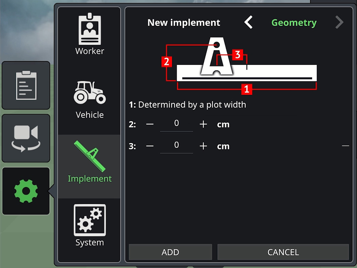
Firstly, the basic settings for the driver, vehicle, and equipment are made.

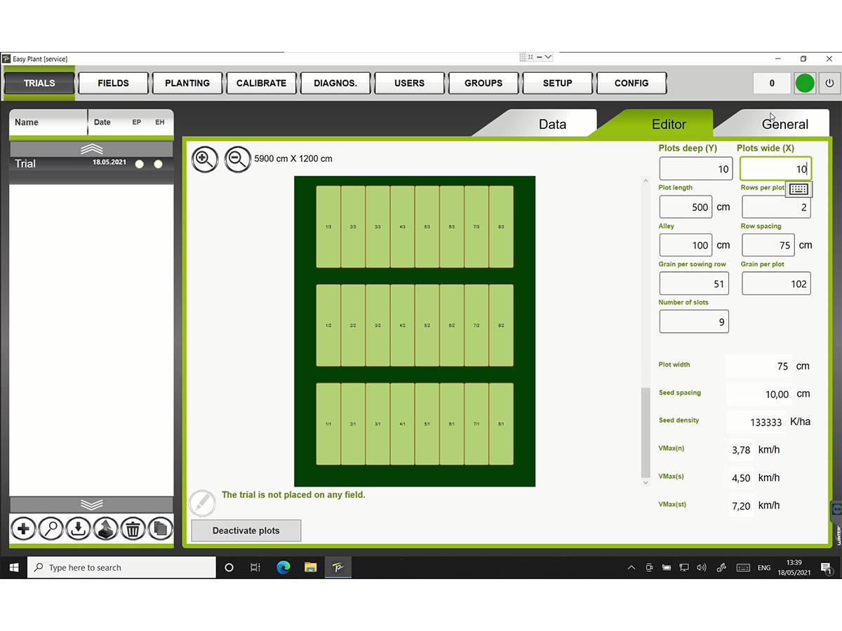
The trial is created in the Easy Plant or eMotion seeder control system.
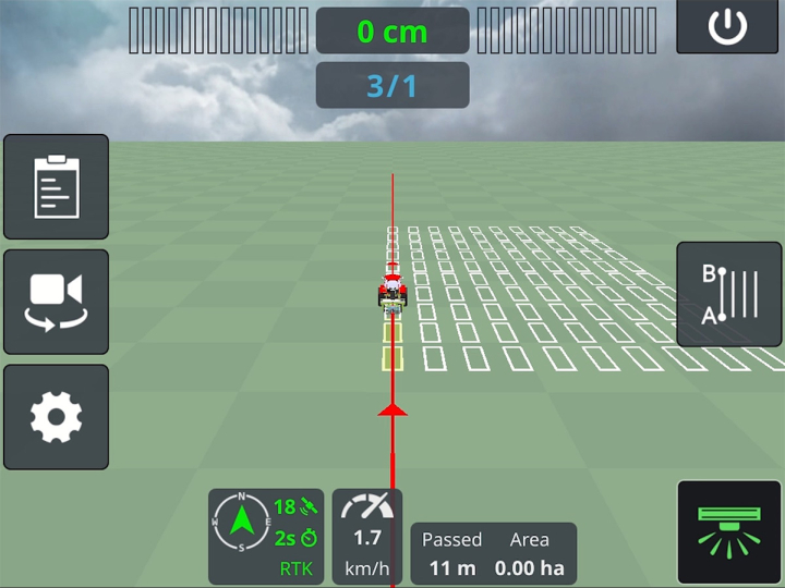
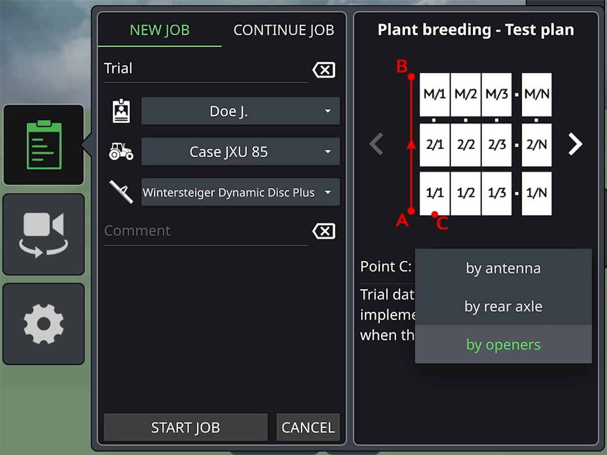
The field plan is automatically synchronized with the Geo Link terminal located in the tractor cab. Now the trial still needs to be geo-referenced to start planting.
The trial is positioned on the field by defining the reference points A, B, and C in the Geo Link terminal. The points can be recorded either directly by moving the machine to the desired points or manually by entering the GPS coordinates on the Geo Link terminal.
Points A and B define the orientation of the trial, point C the position of the trial. Point C is located exactly on the start line of the trial, right in the middle of the first plot. As soon as points A, B, and C have been defined, the trial is geo-referenced and you can start planting.
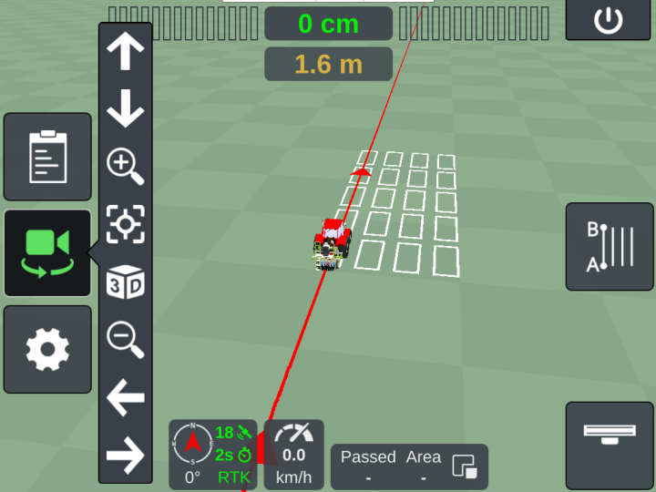
Now the position of the trial, the next track, and the heading are displayed on the Geo Link terminal. Furthermore, the deviation to the next track and the distance to the start line are displayed.
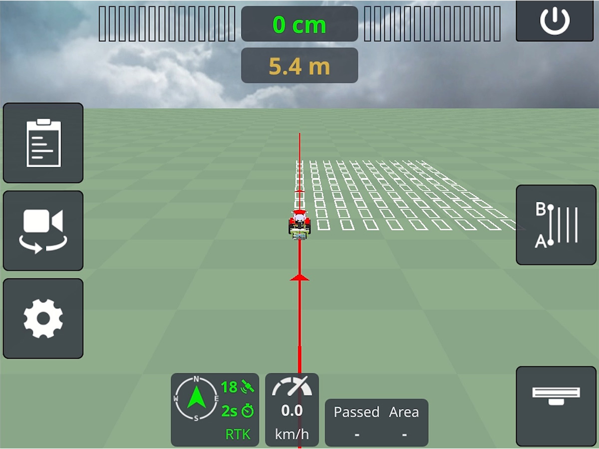
Tractor and machine are moved to the first plot and planting begins. The planting process is started on the seeder via the "Start planting" button.
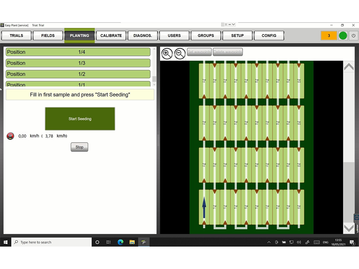
The Geo Link terminal always displays the current position in the trial.

We would be happy to help!
Experienced WINTERSTEIGER sales staff can help you to find an individual solution for your needs!